
It all started with my post of the 31st January. I realised that the maps I included showed the route of Wendover Brook and it might be an idea to follow and photograph it's progress.
The photos were taken over five days, a couple of which were only to check my records. In fact the first photo below was taken on the last day. Where the photos are numbered, these refer to the Google maps that start each section.
Part 1 The Source
The map at the very top is courtesy of a website for The Department for Environment Food and Rural Affairs and a section called Thame Operational Catchment: Water Bodies and a sub section called Bear Brook and Wendover Brook Water Body. Wendover Brook is the blue line. I thought I had found the source of Wendover Brook on the penultimate day where it crosses Lionel Avenue. However the map shows the source near the junction of Perry Street and Dobbies Lane. Here there is a cul-de-sac called St Agnes Gate and so on the last day I went to see what I could find.

What I found was a very high fence, (see below) and even jumping up I was not able to see anything. Until at one point near the end I was able to see the brook and take the photo above. It could be that the area between the fence and what looks like a low wooden rail is actually land belonging to the Environment Agency. And it is their fence that they want to keep it private.


Photos 1 and 2 are those above. Photo 3 below is taken from where the brook goes under Lionel Avenue, actually next door to Number 60.


Photos 4 to 7 below are taken from footpaths in the countryside between Lionel Avenue and Aylesbury Road.


Photos 10 to 12 below are where the brook runs alongside Halton Lane.


Photos 20 below is where the brook goes under the access path from the entrance to the reservoir on World's End Lane.


Part 6 Weston Turville Part 2

Photo 32 is where Wendover Brook passes the private track at the far side of the very end of Mill Lane.

It then passes under Anstey Brook as photos 33 and 34.


And then runs alongside Brook End as photos 35 to 38.


Part 7 Brook End to Bear Brook
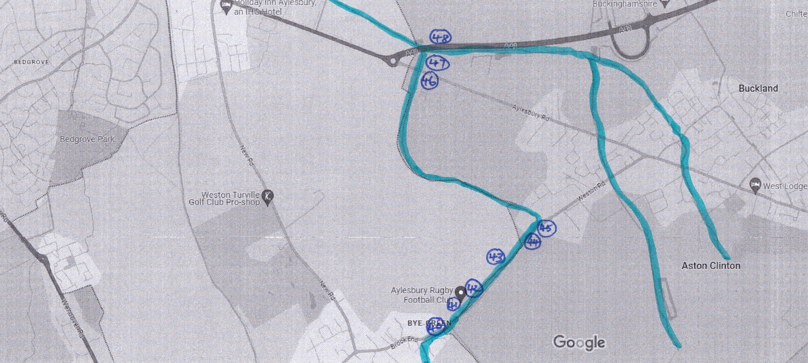
Photo 40 shows where the brook has gone under Brook End.

Photos 41 and 42 are either side of the entrance into Aylesbury Rugby Club.


I then had to cross over Weston Road each time to take photos 43 to 45 as the brook runs alongside the road and the path is on the other side.


The brook reappears near the end of Aylesbury Road. It had followed a farm track (shown on the very right of the photo 46 above) to reach the barrier where it goes under the main road.

It was difficult to see where it came out on the other side of Aylesbury Road, so photo 47 below is the last we see of Wendover Brook.

The brook must go under the new A41 by-pass (photo 48 below) and join the main Bear Brook stream on the other side where there is no access. It's a shame we cannot see where it ends. Bear Brook goes on to Aylesbury and eventually the River Thame as the last photos below.

Below is the full photo from Bear Brook and Wendover Brook Water Body.

And finally "River Thame - Aston Rowant and Chilterns Spring Line Villages on astonrowant.wordpress.com/riverthame/.

No comments:
Post a Comment