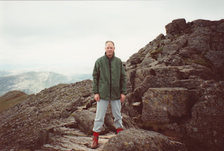
Friday 29 October 2021

Walks in the Lake District - Some Highlights

 Scafell Pike

As I only started posting the detail of our walks in the Lake District in June 2008, soon after I started my blog, there are photos and descriptions that I have never posted before. There was only one place to start for these  highlights and that was in 2003 when we stayed at Riverbank Cottage at Skelwith Bridge. On Monday 16th June we found our way to the top of Scafell Pike (photo above) on a lovely sunny day. Starting at the car park at Dungeon Gyll at 9am, we walked down the road to Stool End Farm and down Mickleden to pick up the main path that eventually takes you to the rocky scramble that is the very steep Rossett Gyll as the photo below. I have had to scan photos from our albums as they have not found their way to computer files.

We passed Rossett Pike to reach Angle Tarn before the steady climb to the main crossroads of Esk Hause. This is where we joined the most direct route to Scafell Pike that comes up from Seathwaite in the Derwent Valley to the north. Our route was far longer but we avoided what would have been a very long drive. It is still a fair way to the top of Scafell Pike. My book records "the last hour from Esk Hause is quite hard, up and down, rocky and lots of boulders". We made the summit at 1.45pm, a long four hours and twenty minutes.

We decided to take the long way back via Esk Hause and Bowfell. This meant a descent to Ore Gap before climbing AGAIN to Bowfell summit. Then down to Three Tarns and an easier descent down The Band. I can always rembember the last two hours felt really hard, especially the last mile or so along the road from Stool End Farm. We arrived back at the car park at 7.15pm. We were out for just short of ten hours, my longest ever walk. And never repeated. But it was an exceptionally beautiful and sunny day. My last note for the day records: "Went to The Britannia for dinner and sat outside in the late, light evening". Or was it night by then?

My notebook for 1996 (that is twenty five years ago) says that we climbed Rosset Gyll with the intention of making it to Scafell Pike but turned around at Angle Tarn as the weather deteriorated and the tops were in dense cloud. Instead we "only" found our way over the tops of the Langdale Pikes: Pike O Stickle and Harrison Stickle, and back via Stickle Tarn and Stickle Gyll.

Helvellyn

Records show that we have been up Hevellyn three times. The first was in our initial visit to the Lake District in 1991. I think we started off on the route that takes you past the Youth Hostel , up to Whiteside and on to the summit of Helvellyn before the route back via Striding Edge looking over Red Tarn. Photos below from an old album. I'm having to guess where they were taken. The first looking back to the Grisedale Valley.


A view over Striding Edge and Angle Tarn.


Approaching the summit.


At the start of Striding Edge.

We repeated this walk again in 1994, this time with Alison's sister. The notebook says we followed the route from our trusty "Walker's Companion"  by Colin Shelbourn, which is the opposite way round to the first. Here is a better photo this time of Angle Tarn.
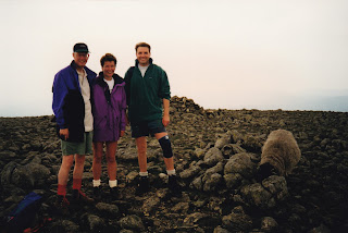
At the summit.

In 2002 we followed that same route, from Glenridding  and the Grisedale Valley, Striding Edge and the scramble up to the top. Back via Whiteside and the Youth Hostel. My notebook says there were "fantastic views from the top". Reading "Walker's Companion" again, I now remember what is described. First there are two routes along Striding Edge, walk across the top of the ridge or, as I preferred, a path just below the top. Either way, all pretty scary. The book continues: "As you come off Striding Edge, there is a short climb down a rock column, known as "The Bad Step" then a steep scramble before you arrive at the summit". The only thing that got me down (or up when we went the other way) what is called a chimney was the thought that this was the only way to go. Here it is. Scary or what.


High Street

We first walked High Street in 1995. Since then it has always been one of our favourites Using our trusty "Walker's Companion" we were able to park in Hartsop village. The tiny car park was full the next two times in 2000 and 2016 when we parked in Patterdale resulting in a slight increase in the original 9 miles. However my post of 19th July 2016 says it was a "very nice path up".


Photos here from our 2016 walk. Angle Tarn was pretty in the sunshine.


There were some great views back to the valley.


High Street has this long flat top.


There are panoramic views from the top and I remember talking to a walker who pointed out all the fells. We could even see Windermere and Morecombe Bay. 


We always turned around at the top and retraced our route back down to Patterdale. There are also views of Hayeswater, Brothers Water and Ullswater on the return as well as Martindale.

Fairfield


It's a long time since we walked the full circular route that is the Fairfield Horseshoe. So I only know we walked it in 1997 (from which I found two old photos) and 2000. Trying to remember where we started, I looked at the map and found Low Sweden Bridge which is on the path out of Ambleside where we parked. I did have a note to say we used a Wainwright guide but only found it in the huge book that is "Fell Walking with Wainwright" with lots of big colour photographs. This classic route up to Fairfield takes in Low Pike, High Pike, Dove Crag and Hart Crag before reaching the summit of Fairfield at 873 metres. Most of the route is fairly easy, just very long. The descriptions in the book tells it all. Here we are at the top in 1997 with our brother-in-law who came with us in 1997.


The route back takes in Great Rigg, Heron Pike and Nab Scar before coming out near Rydal Mount. There is then the trek on the flat back to Amblesdide. The walk is over ten miles, but it is the ups and downs that make it a challenge.


Crinkle Crags and Bowfell

My notebook records that we walked Crinkle Crags and Bowfell with Alison's sister in 1998. Again I'm having to remember the detail of this walk as my notebook only said where we went rather than the detail that I recorded from 2001. I'm pretty sure that having parked once again at Dungeon Gyll, from Oxendale we headed up towards Pike O Blisco but turned right past Great Knott before finding the first of the Crinkle Crags. This is the photo I took from below this year. Crinkle Crags is the high ridge on the left and Bowfell peeking out on the right.


This old photo is the view from one of the Crinkles down the Langdale valley. The Wainwright book has magnificent pictures from the five tops.

Leaving Crinkle Crags the route descends to Three Tarns. No photo in the albums but Wainwright does. Three Tarns is the crossroads of five main paths including the one up to Bowfell which is the one we took. I think the old photo below was from the top.


I'm pretty sure we must have come down via The Band and Stool End Farm. Not sure why we had only walked this route once.


Easedale Tarn, Sargeant Mann and High Raise

Now this is a walk we have done many times: 1999, 2000, 2001, 2005 and more recently in 2015. Staying in Grasmere we do not even half to take the car. The walk up to Easedale Tarn is a popular route and you are never far from other walkers. The tarn itself can be quite busy.


We then leave the crowds behind and head up the path (steep in places) to Sargeant Man. Great views from the top. My notes for 2015 say "views to the Scafell range and across to Morecambe Bay".


Then on to the flat summit of High Raise which we always consider to be the very centre of the Lake District, or at least for the Central Fells. My notes for the 22nd June 2005 record that "views to Skiddaw and Keswick etc are fantastic". It is like a 360 degree circle of distant fells.

We used to have trouble finding the path for the route down and often went off piste. But if you go downhill in a north westerly direction you always hit the main path that is a right turn to Far Easedale and a long gradual descent.  However in 2005 I noted "found the right path down for a change .... six hours fifty minutes". In 2015 I noted "I think we must have been out for about 8 hours (my notebook says 6.5 hours the last time) but I'm sure the mountains have got higher and the scrambles steeper than when we were last in The Lakes seven years ago. Or is it just my age?"


Ullswater

This is one of the moderate routes in Walker's Companion, a walk that we have done many times: 1994, 2000, 2006, 2017 and 2019. It is "only" six and a half miles but there are lots of ups and downs (for a lakeside walk) and nearly four hours including stops. It does mean a thirty five minute drive to Glenridding and a wait for the ferry to Howtown. Always nice views from the boat.


I now see that in 2006 we actually walked from the car park to Howtown and get the ferry back. I can remember wondering if we had missed the last ferry. There are more photos and notes on my blog postings in 2017 and 2019. 


OTHER WALKS

Helm Crag and the Easedale Ridge 

Not one of Alison's favourites, but I quite liked this walk from 2018 and 2019. It is not really in any guide books except Bob Allen's "The Best Walks in the Lower Lakeland Fells - Book Four: South East". And having climbed Helm Crag, it is nice to carry on the ridge walk. This is the summit.


There are lots of photos on my blog postings in 2018 and 2019 as the long ridge takes in Gibson Knott and Calf Crag. On the map, the path then disappears which must put off a lot of people. But we have always found our way to another main crossroads of paths at the junction with Far Easdale. Alison always carried on to High Raise and Sargeant Man while I took it easy back down Far Easedale. The blog posting of 


Cat Bells

Another very popular walk and a long drive from Grasmere to Keswick. We went in 2005 and 2016. From Keswick we take the launch to Hawes End as the route described in Walker's Companion. Again the walk in 2016 is on my blog posting in July. I do remember that one time we met up with another group towards the end and again wondering if we had missed the last ferry back from Hawes End.


Skiddaw

Just the one visit in 2008 when we stayed at the Derwent Manor Apartment in Honister. 


Again we followed the route in Walker's Companion. There are great views from the top, even if the summit itself is not very interesting. Blog posting from 2008.


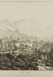
Finally there are other walks such as those for the Langdale Pikes, Silver How, Rydal Water , Wansfell Pike, Lingmoor Fell, Gowbarrow Fell, St Sunday Crag, Tarn Hows, Alcock Tarn, Haystacks, Buttermere, Loughrigg Fell and Little Langdale, most of which are on my blog  It has been a pleasure revisiting these places that have been a big part of our lives over the last thirty years.

Monday 25 October 2021

Our Holidays in the Lake District


Our first time on holiday in the Lake District was in 1991 and ever since then I have kept records of our time there in a small note book. I made a summary of our visits in my post of 30th June 2015. I missed out what we did on wet and rest days. Since our visit in September 2001, the notebook contains a lot more detail of what we did each day including notes about the weather. I first entered a post on my blog in June 2008 but then we went seven years without a visit. That was until 2015 (post of 2nd July 2015) when we found Coachman's Cottage in Grasmere (post 1st July 2015) and that was the start of seven consecutive years there, only broken by the pandemic in 2020. I have now updated the earlier summary.

1991  The Queen's Head, Hawkshead

Walk from the pub to Tarn Hows
Helvellyn via the Youth Hostel and Red Tarn


1994  Ullswater House, Glenridding

Ullswater Circuit (Walker's Companion) 
Hellvelynn (Walker's Companion) 
Rydal Water circuit
Dockray to Aira Force


1995 Chapel Stile

Allcock Tarn (Walker's Companion)
High Street (Walker's Companion)
Lingmoor Fell
Helm Crag (Wainwright)
Silver How


1996 Chapel Stile

Elterwater and Little Langdale (Bob Allen)
Rossett Gill and the Langdale Pikes (Walker's Companion)
Grasmere and Rydal Circuit (Bob Allen)
Wansfell Pike and Troutbeck (Bob Allen)


1997 Chapel Stile

Lingmoor Fell (Walk the Lakes)
Loughrigg Fell (Bob Allen)
Fairfield Horshoe (Wainwright)
Easedale Tarn (Walk the Lakes)
Buttermere
Black Crag (Walk the Lakes)

1998 Chapel Stile

Silver How, Great How, Stickle Tarn and Dungeon Gill
Crinkle Crags and Bow Fell (Wainwright)
Fell Foot Park and Tarn Hows
Easedale Tarn

1999 The Garden Chalet, Elterwater

Silver How
Easedale Tarn and High Raise (Wainwright)
High Street
Little Langdale (Bob Allen)

2000 The Garden Chalet, Elterwater

Little Langdale (Bob Allen)
High Street (Walker's Companion)
Easedale Tarn, Sargent Mann and High Raise (Wainwright) 
Loughrigg Fell and Loughrigg Terrace (Bob Allen)
Ullswater
Fairfield Horshoe (Wainwright)

2001 Chapel Stile (June)

Paths closed due to foot and mouth

Elterwater
Tarn Hows

2001 Chapel Stile (September)

Grasmere and Rydal
Silver How, Blea Rigg, Stickle Tarn and Dungeon Gill
Easedale Tarn, Sargent Mann and High Raise (Wainwright)
Loughrigg Fell and Loughrigg Terrace (Bob Allen)
Little Langdale (Bob Allen)

2002 Chapel Stile

Loughrigg Terrace
Pike O'Blisco (Wainwright)
Little Langdale (Bob Allen)
Hellveyn (Bob Allen)
Grasmere and Rydal Water
Tarn Hows

2003 Riverbank Cottage, Skelwith Bridge

Helm Crag (Wainwright)
Little Langdale (Bob Allen)
Scafell Pike via Rossett Gill, back via Bow Fell and The Band! (Wainwright)
Easedale Tarn and Codale Tarn

2005 Riverbank Cottage, Skelwith Bridge

Little Langdale
St Sunday Crag (Wainwright)
Loughrigg Terrace
Easedale Tarn, Sargent Mann and High Raise (Wainwright)
Cat Bells (Walker's Companion)

2006 Riverbank Cottage, Skelwith Bridge

Helm Crag (Wainwright)
Ullswater and return by ferry from Howtown (Walker's Companion)
Easedale Tarn
Rydal Water
Little Langdale (Bob Allen)

2008 Derwent Manor, Honister

Haystacks (Walker's Companion)
Skiddaw (Walker's Companion)
Loughrigg Fell and Loughrigg Terrace (Bob Allen)
Gowbarrow Fell and Aira Force (Bob Allen)

2015 Coachman's Cottage, Grasmere

Lang How 
Easedale Tarn, Sargent Mann and High Raise (Wainwright)
Tarn Hows 
Little Langdale (Bob Allen)
 Run Great Langdale
Fellfoot Park parkrun

2016 Coachman's Cottage, Grasmere

Longford parkrun (not actually in the Lake District)
Allcock Tarn (Walker's Companion)
Scandale and Low Pike
Cat Bells (Walker's Companion)
Run Great Langdale
Patterdale to High Street (Walker's Companion)
Ambleside
Fell Foot Park parkrun

2017 Coachman's Cottage, Grasmere

Lyme Park parkrun (Not actually in the Lake District)
Loughrigg Fell and Rydal (Walking Country Lakeland Fells)
Ullswater (Walker's Companion)
Holehird Gardens
Elterwater run
Allan Bank
The Band, part Bowfell and Three Tarns
Keswick
Fell Foot parkrun

2018 Coachman's Cottage, Grasmere

Allan Bank
Elterwater and Little Langdale (Walk on the Lower Fells)
Holehird Gardens
Helm Crag and the Easedale Ridge (Walking Country Lakeland Fells and Collins Central Fells)
Grasmere and Rydal (Walker's Companion)
Stickle Gyll. Stickle Tarn and Blea Rigg (Collins Central Fells)

2019 Coachman's Cottage, Grasmere

Run Grasmere
Allan Bank
Easedale Tarn and Far Easedale (Bob Allen)
Elterwater and Langdale Valley
Run Langdale Valley
Wordsworth Re-Imagined Project
Ullswater (Walker's Companion)
Helm Crag, Calf Crag and the Easedale Ridge (See above)
Fell Foot parkrun

2021 Coachman's Cottage, Grasmere

Dunham Massey
Silver How (Wainwright)
Holehird Gardens
Allan Bank
Wordsworth Museum
Easedale 
Great Langdale

Saturday 23 October 2021

William Wordsworth's Guides to the Lake District


When we visited the Wordsworth Museum in Grasmere, I had no idea that William Wordsworth had published guides to the Lake District. It was a display of the book above that was called A Guide through the District of the Lakes in the North of England etc that caught my eye. It was described there as the Fifth Edition. The image below I found credited to Brigham Young University (more later).

What I really wanted to know was what had happened to the previous editions and the following study is a result of my researches. But Wordsworth was not the first to publish a guide to the Lakes. That is accredited to Thomas West in 1778. Here are all five editions in chronological order.

The First Edition

It was when Wordsworth's friend and artist  the Rev Joseph Wilkinson wanted an introduction to his 1810 series of engravings called Select Views of Cumbria, Westmoreland and Lancashire, Wordsworth obliged.  This is referred to as the First Edition of his Guide. The whole of Wordsworth's anonymous introduction to Select Views is on Romantic Circles website romantic-circles.org. Select Views in Cumberland, Westmorland, and Lancashire (1810) | Romantic Circles (romantic-circles.org)

Here is the first page of Wordsworth's introduction.

The following is an extract from Romantic Circles website:

 In accepting the Select Views commission, Wordsworth had two distinct assignments. The first, offering a general survey of the Lake District, was fulfilled by his 34-page "introduction" . The second, describing vistas or landmarks featured in Wilkinson’s sketches, proved considerably more vexing. 

On the same website are a selection of the engravings by Joseph Wilkinson from this book of Select Views etc. " Gallery of Engravings of Joseph Wilkinson's Drawings". Here are a couple:


The one above is Elterwater and the one below of Rydal.


The Second Edition

It was in 1820 that similar words were included in Wordsworth's own book of poetry that was called The River Duddon, A Series of Sonnets and this is referred to as the second edition.

The list of contents include the final line Topographical Description of the Country of The Lakes. The full text is on archive.org and credited to BYU.


The Third Edition

As interest in tourism to the Lake District increased, Wordsworth published in 1822 his own A Description of the Scenery of The Lakes in the North of England Third Edition, now first published separately, with additions, and illustrative remarks upon the scenery of the Alps.


Wordsworth was keen to note on the title page that this work was published separately to those earlier editions and that there were new additions. The full text can be found on:
https://archive.org/details/adescriptionsce01wordgoog/page/n3/mode/2up?ref=ol&view=theater

The Fourth Edition

A Fourth Edition came out  only a year later in 1823 with the same title as the Third Edition.


Go to: https://wordsworth250.byu.edu/about and there under "Exhibition Catalogue"  is A Description of the Scenery of the Lakes in the North of England 4th Edition 1823". And below the front cover photo are the words This is the 4th edition of the work commonly known as Wordsworth’s Guide to the Lakes. It expands upon Wordsworth’s previously published descriptions of the Lake District (1810, 1820, 1822), the earliest of which appeared as the anonymous introduction to Joseph Wilkinson’s 1810 Select Views of Cumberland, Westmoreland, and Lancashire and as an appendix to Wordsworth’s 1820 River Duddon volume of poems. 

The Fifth Edition

And so we come to the last of these editions as the pictures at the top. This is what is now called the definitive work: the Fifth Edition of 1835 that has the full title Guide through the District of The Lakes in the North of England with a Description of the Scenery, for the use of Tourists and Residents Fifth Edition with Considerable Additions by William Wordsworth 1835. It is this edition that the museum proudly displays. 


Summary

It had actually taken me a lot of research to get these facts and images into a positive chronological order. You would think that for such an important document it would be so simple to follow online. However the best link is "Wordsworth at BYU". This is an online Exhibition for the poet's 250th anniversary in 2020 by Brigham Young University in the USA. "A formal relationship with the Wordsworth Trust takes hundreds of BYU students each year into the heart of William Wordsworth’s Lake District".

I really would like to see the museum display all five editions set out in a row. When I first saw the fifth edition, I immediately thought that the previous editions would all have the same title, which I thought was usual in publications. But that is not so. Displaying all the editions side by side would dispel any such question. 

Guide books and maps have, to me, always been fascinating as the picture below might show. Wordsworth was one of the first in a long line of authorities on The Lake District to let us tourists get to know these wonderful fells.